We left Part 1 IPA in the USA at the point of impending departure from the very budget motel in Lewiston Idaho on day six of the adventure to continue east on Highway 12. It is unlikely that any day of the trip had been so thoroughly scrutinised, analysed, Google Earthed and finally coin-tossed, due to the competing route options of Highway 12 via Lolo Pass, or the more northern St Joe’s River Road as they both end up in Missoula. Heads had come up, so it was Highway 12, which at least made the GPS and maps un-necessary because Lewiston is at one end and Missoula is at the other.
Some random trawling of the internet the previous evening by Cindy in the very budget motel, while I looked furtively out between a crack in the curtains expecting to see a drug deal go down on the handy surface of her 700GS BMW panniers, had come up with a nearby short road invitingly called the Old Spiral Highway. Motorcycleroads.com gave it 4.3 out of 5, with perfect scores for the scenery and the road quality, but a low score for amenities which are only required for those whose planning skills are at early toddler level as it is 11km long. And if you haven’t allowed enough fuel for the full 11km you can coast the whole way back down to Lewiston anyway, so it was happily added to the itinerary.
After lubrication of bike chains and departure from the very budget motel which had actually turned out to be comfortable and quiet, it was over the Clearwater River to the industrial area where a small diner was just opening for breakfast. The best soft poached eggs of the trip were accompanied by the never ending offers of more coffee, on this occasion politely refused after the first cup due to the lack of amenities for the next 11km. Once finished with breakfast and onto the Old Spiral Highway, the motorcycleroads.com scores were quickly confirmed and the relentless corners on the gradual gradient up the steep valley side received perfect 10s from both the 700GS and 800GS judges.
After lots of high fiving and photography at the top and trying to trace the path of the amazing road we had just come up, it was onto Highway 12 to resume the trek east. The Highway 12 follows the Lewis and Clark trail up the Clearwater River, then the Clearwater River middle fork, then the Lochsa River which forms the main valley rising to Lolo Pass. Getting over Lolo Pass and the Bitterroot Mountains in the very cold autumn of 1805 was one of the greatest challenges faced by the explorers, who battled wet and freezing conditions for 11 days before reaching more hospitable terrain on the western side.
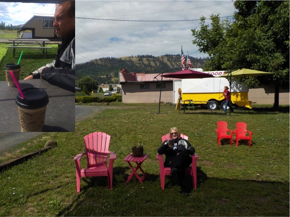
As is common in motorcycle travels, our timing of need for coffee and arrival in suitable towns sporting coffee vendors became slightly misaligned, resulting in a later coffee than would be absolutely perfect in the small town of Kamiah. The drive-through coffee vendor made up for the caffeine delay with a nice latte and cappuccino, and also provided exposure to some additional coffee technology that we had not previously experienced. The cappuccino came with the option of ‘wet’ or ‘dry’, meaning with more milk or more froth, and thin straws were provided as heat exchangers to ensure the very hot coffee could be controlled at the right temperature into the mouth by varying the vigour of the sucking.
From Kamiah the road continued east through Kooshia where the Clearwater River splits into the south and middle forks, before hitting the interestingly named small town of Syringa which turns out not to come from the Nez Perce Indian word for “pointy stick which Medicine Man jabs in bum”, but is actually the Idaho state flower. Sometimes you need to research these things to get the facts rather than make assumptions.
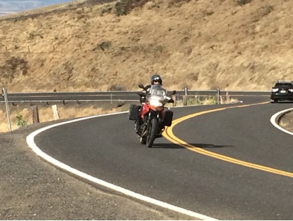
After Syringa starts the real fun, a journey beside the beautiful Lochsa River on one of the 15 top motorcycling roads in the USA which commences with a sign stating; Winding Road Next 99 Miles. It is a great example of a US road built to very high specification; even though winding you could set the cruise control and sweep the beautifully cambered corners at the speed limit the whole way. The only challenge is getting the chameleon eyes working to watch the road and look at the beautiful river views at the same time.
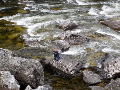
As it was Saturday, there were a few locals set up on the occasional small patches of sand on the thin bank of the river for fishing and some even had a tent pitched on the bitumen road shoulder in one place, possibly to provide a discreet changing room or restroom as amenities were not part of the road build. Easy access down to the river from the road is quite infrequent, resulting in having to scramble our way over large boulders to get a close up view of the clear rushing water. The large boulders did become quite helpful when it was time to find a discrete room to have a rest in however.
Eventually the road climbed up out of the valley and we reached the Lolo Pass visitors centre at 1,600 metres, with some addition to wardrobe required with the significantly lower temperatures. Lolo Pass is at the Idaho and Montana border, so we had spent less than 24 hours in the narrow northern part of Idaho, even with putting the watch forward an hour to US Mountain Time.
The timing of the change in time zone, as always seems to happen when crossing into NSW from QLD in summer, meant that a planned late lunch suddenly became a “linner”. The concern that no restaurants would cater for linner were calmed by a large buffalo burger in the Lolo Hot Springs tavern, where the friendly staff took turns asking if we wanted a refill of our half gallon cup of soft drink every time they walked past. As we were uncertain of the availability of amenities over the sweeping and downhill half hour ride at 75mph into Missoula, we just stuck with the one.
Missoula turned out to be the second largest city in Montana behind Billings, so the accommodation options in the centre of town along the Clark Fork River were fairly extensive which was fortunate as it gets very crowded in the height of summer. The Holiday Inn was booked out, so fortunately a more budget but very acceptable option in the same location was the result. As we’d had linner, we rejected the waitress’ advances with menus at Tamarack Brewing (where the Wi-Fi password was an encouraging drinkmorebeer) and went with a couple of pints of very nice IPA for me and some local wine for Cindy to keep the record intact and round out the enjoyable riding day. The problem with the linner concept became obvious at about 8pm, when a dupper of some take-away empanadas was required to achieve the three meals per day minimum standard.
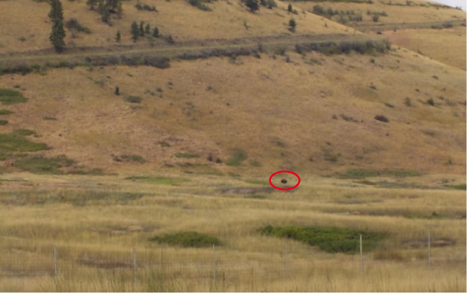
The last day of the first week was a manageable 240km from Missoula to West Glacier, so the National Bison Range spotted on the way at Dixon did not stress the schedule, particularly as the rules at the visitors centre stated motorcycles were not permitted to traverse the bison circuit. Discussion with staff revealed that the reason was not because bison were prone to getting up close to vehicles; they had probably learned this wasn’t a great idea when they nearly became extinct in the 19th century, but because the road was gravel. Even though lumbering RV’s were entering the circuit behind us, we decided not to argue the point and show photos of some typical “roads” taken on our Off-Road Skills training on GS’s, and accepted the rules which were probably the natural result of some Harley rider’s over-confidence. We were directed to a small lookout behind the centre, as a bison had apparently been spotted out on the range that morning, which turned out to be true but left us feeling regret that we hadn’t packed binoculars.
Leaving the Bison National Range with a similar feeling to having just met Prince Andrew, we continued the ride north to West Glacier via the east side of Flathead Lake and Bigfork. Flathead Lake is the largest lake west of the Mississippi and is the liquefied result of an enormous ice-age glacier that became stranded between the mountain ranges on each side and the huge pile of glacial moraine it had pushed up in front of itself.
West Glacier was reached after 1pm, and a motorcycle-free rafting tour with dinner was spontaneously booked for 2pm with the Glacier Raft Company, giving us 40 minutes to find a budget hotel in peak summer, get changed for rafting, have lunch, and get back. It is amazing what you can achieve under pressure, we made it back with minutes to spare to join the raft group for a trip up the Flathead River in buses and a long trip down in rafts through a fun series of class one to class three rapids in glorious warm conditions.
Temptation to have a swim along the calm sections between rapids was too much for some of our fellow crew members, although our Brisbane aversion to contact with anything cool meant that we later avoided the onset of hypothermia while those who had succumbed to temptation sat around in their wet clothes. A pleasant river-side BBQ and salads concluded the tour, however no alcohol was served so we were forced to wander around West Glacier tourist village until we found a pub with boutique IPA to keep the record going for one more day.
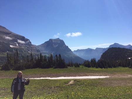
Up bright and early as usual the next day for the routine of discovering which phone/iPad/Sena communicator/camera had missed out on being re-charged before deciding that 40% battery life might be enough for the neglected article, we prepared to set off on the road that had effectively set the USA itinerary and route. The Going-To-The-Sun road is iconic, and it is unusual in that its main purpose back in 1921 was to provide a scenic tourist road for vehicle traffic to move from one side of the Glacier National Park to the other. The 80km long road engineering alone is spectacular, with nearly sheer slopes traversed through the mountains before reaching the highest point of 2,000 metres at Logan’s Pass.
The road is closed for a significant part of the year due to very deep snow, which means that in summer the traffic can be horrendous. We left early to get a clear run, however with a 5km backtrack required to unsuccessfully look for Cindy’s glasses which had tragically been left on her pillion seat at a photo stop, we ended up back in the maul of cars, RV’s, and tour buses. The winding road was one spectacular vista after another, resulting in many photo stops for fear of missing a potential “money shot”.
We made it up to Logan’s Pass in late morning to find the car park was absolutely chokkas, however as we were on motorcycles we found a spot within 3 yards of the visitor’s centre quickly enough to inspire looks of envy bordering on hatred from the sweating four wheelers who had walked about 1 km uphill from the overflow car park. Glorious views were observed in every direction from the short walking circuit, before a quick exploitation of the conveniences in the centre and mounting up for the descent. The ride down the eastern side past the beautiful Saint Mary Lake which featured in the Forrest Gump movie was a lot faster than Tom Hanks could manage it running, as it was lunch time and we hadn’t even had a coffee.
A bite to eat in Saint Mary, then it was south to Two Medicine Lakes which had been recommended by a friend as beautiful as other areas of the park and far less touristy. A wrong turn accidentally took us to the town of Browning, where Cindy dropped her GS to celebrate reaching the most easterly point of our motorcycling journey, before commencing the journey back west to East Glacier town and into Two Medicine Lakes. The lakes are ringed and protected by the high mountains to the west, and as it was now quite hot and still we needed little encouragement to take the boots off and destroy the pristine aura of the scene by paddling around in the shallows cooling our sweaty feet. We kept close to the boots just in case bears were attracted by our sweet smelling socks and we needed to make a quick escape.
The last leg of the day was north following an Alaskan 1200GS rider and his companion Triumph 1200 Explorer rider to bid the USA goodbye and get into Alberta, Canada at the Chief Mountain border crossing. The GS rider barely acknowledged or spoke to the Triumph rider, so I took pity and struck up a conversation with the oppressed species who said he was very happy with it. I didn’t even bother asking the GS rider because of course he was happy. The crossing took 1 minute, and mostly entailed discussion with the Canadian official about how beautiful it was (the scenery, not my 800GS even though I could see he was mentally riding it). After the usual disappointing immigration procedure of watching him select a random blank passport page and putting a small stamp right in the middle, we rode the short distance for the planned overnight stop at the Prince of Wales hotel in Waterton happily reminiscing on the fact that we had managed a week in the USA without a break in the IPA theme.
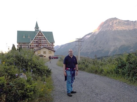
Waterton Lakes National Park is just the Canadian end of Glacier National Park, and is equally spectacular. The Prince of Wales hotel looks a bit like a cross between the Norman Bates’ Psycho house and the hotel in The Shining, but the views from the hill over the lake valley and the mountains were well worth the high season prices. The hotel had actually been built in the 1920’s to entice American visitors to cross the border as they were suffering under prohibition and could not legally get boutique IPA in Montana. After a legal IPA and a snack to commemorate this historical precedent we walked the kilometre or so down to the Waterton town which was small but complete with tame deer and loads of squirrels wandering about on the lawns. After the inevitable failure to find stickers of the US or Canadian flags for our helmets back home, we headed back to the hotel for bed and a lesson rammed home by a small boy next door that 1920’s hotels were not particularly well sound insulated. Lucky there was no TV.
Riding day No.9 was one of the highlights of the holiday. We left Waterton reasonably early in spite of a breakfast waitress who seemed easily distracted by shaggy dog trekking stories from some other patrons, and headed north. We headed north, then west along Highway 3 through the historic mining town of Frank, which became history one night in 1903 when an 80 million tonne section of the mountain above it failed. The rock slide dimensions are huge, and the highway and rail line run through narrow cuttings in the field of huge boulders which still contain most of the bodies of the estimated 70 – 100 people believed to have been in the slide’s path.
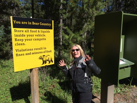
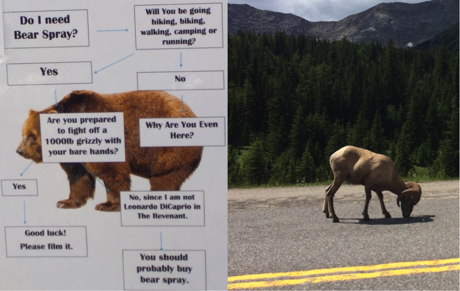
At Coleman, we filled up with fuel, gathered luncheon provisions, asked questions regarding the dirt Highway 40 heading north, ignored the obviously wrong answers from locals that it was only 30km of gravel, and headed off. The road condition was very good, mostly hard packed but with occasional corrugations and newly laid beds of gravel that made the bikes drift about on tyres with low off-road tolerance. We were on our own in the forests with very little traffic, which brought the bear-o-phobia thoughts to the fore. I had already been guilty of coming over a rise and assuming the large brown animal on the side of the road was a grizzly inspired by The Revenant only to find it was a disinterested cow.
The fascination with bears had been building since first contact with warning signs, bear-proof bins and other anti-bear paraphernalia such as the widely advertised bear spray. Cindy was the bear guru of the party with her “if it’s brown lie down, if it’s black fight back”, but as she always rides at least 200m behind me and had lost her glasses, it was likely that she would unhelpfully ride past the huge and brown-but-nearly-black grizzly bear playing with my corpse.
Regrets about not having bear spray meant that bear attack scenarios were running wildly and I was mentally practicing how I would do a calm U-turn upon contact with an enraged animal, get the bike across the road to protect Cindy, give her urgent yet positive reinforcement via the intercom to turn around, and together we would show the charging grizzly the futility of challenging BMW motorcycles by spraying it with gravel as we accelerated away. So contact with an elk after coming around a sharp corner had not been practiced at all, resulting in synchronised soiling by self and the very large animal which fortunately got off the road incredibly quickly and pranced up the hill into the trees.
The actual distance of the Highway 40 and the Range Road 51A gravel roads turned out to be 105km, with glorious scenery and just enough traffic to frighten grizzlies away. Once we reached the end of the dirt, there was a very wide open space at the Cataract Creek snowmobiling car park which provided wide panoramas in all directions with enough time to detect bears, throw our lunch of sandwiches and chips to distract them, and remount the GSs for a quick get-away. Having finished eating the distractions, we got back onto the bikes and joined the bitumen part of Highway 40 which is known as the Kananaskis Trail, probably because it goes to Kananaskis. This road is a scenery assault for most of the way up to Highway 1, with the Rocky Mountains just to the west forming the border between Alberta and British Columbia and demanding constant stops to take photographs.
Although we had been denied bears, as we rode around a corner in convoy with some other head-swivelling motorcyclists, a flock of Big Horn Mountain Sheep raced from a grassy knoll toward us. The personal response to a charging mob of sheep is confused and mixed; one moment accelerating to escape, the next slowing down when the thought that they are bloody sheep kicks in, and repeat. Fortunately we got past the sheep before it had looked too obvious to the large crowd in a nearby RV park like we were trying to escape. Passing a sheep intently grazing on the bitumen a bit further on while lush grass was only metres away did not initiate a re-assessment of their lowly position on the intelligence spectrum, who knows what they are capable of doing.
As we had missed out on coffee due to over 200km of riding without any form of café appearing, we called into the skiing and activities resort of Kananaskis to right that horrible wrong. After a calming cappuccino and skinny latte and checking the route to ensure we probably didn’t need to purchase bear spray just yet, we continued to the end of Highway 40, made a westerly turn, and headed toward Canmore and Banff. We still had 30 seconds left on our 24 hour National Parks Canada pass that we had purchased to enter Waterton the previous day, so we righteously took the unmanned “already have a valid pass” lane on the Highway 1 checkpoint, and subsequently wondered why everyone else didn’t.
Arrival into the physically small town of Banff was the opposite of the rest of our day, cars and tourists were packing the place, and after some confusion by Google Maps as to the precise location of our hotel on the main avenue, we parked the bikes in an underground car park where the already expired National Parks passes were out of sight, and checked in.
The evening was spent preparing for our second rest day by lying on the bed doing absolutely nothing, eased by some pre-loading on IPA and an 8 beer sampler selection and a giant pretzel at a boutique brewery restaurant. The week since Seattle was toasted as a complete success, the bikes had performed flawlessly, we had seen some truly spectacular country, and had a great time seeing off the usual challenges of riding motorcycles without issues. The last third of the trip still to come had some big Canada questions, but none was bigger than would we finally need to buy bear spray, eh?
End of Part 2
