Stories of pumas and panthers wandering the outer urban and rural areas of Australia abound. Most have heard the rumours; the large felines were brought over by American soldiers in WW2 and were released, they escaped from a zoo, or they were the result of a crazy cat lady’s pet numbers reaching critical mass. Rarely are the stories first hand and are never backed up by photographic evidence – usually a friend of a cousin’s mate woke up to find one in his tent, fair dinkum. I was always a hard-line sceptic, until……..
The purpose of the trip was to spend a week in Nowra (south of Wollongong NSW) in early January with our son and his family. Cindy’s idea of completing one of our “bucket list” activities of visiting the historic gold mining town of Hill End near Bathurst on the way down was enhanced by her follow-up brilliant idea of riding and doing a scenic tour. The planning phase quickly went into overdrive over the Christmas period, with multiple route options developed and visually travelled on Google Maps on the laptop and Mud Maps 3 (excellent Christmas present for adventure riders) on the iPhone before final selection of a path through Beaudesert, Kyogle, Grafton, Glen Innes, Tamworth, Merriwa, Mudgee, Hill End, Bathurst and Goulbourn with plenty of off-road sections to keep Cindy’s 700GS happy.
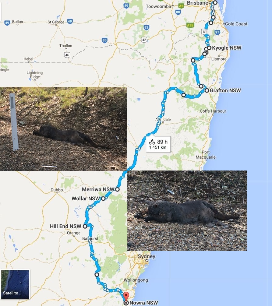
We set off early on New Year’s Eve having convinced the dog that she would almost certainly meet someone involved in smoked bacon production in her boarding kennel, while the cat was just dropped off without explanation as she doesn’t appear to comprehend English. The route from the planned coffee stop at Beaudesert (the residents assumed that the 31st December was a public holiday – Maccas the resulting fall-back) to Kyogle was via Lions Road and The Risk, a fun road we have become very familiar with since the BMW MC club Christmas Party having previously been unaware of its existence. A quick refuel in Kyogle preceded a section on the dirt to prevent unnecessary tyre wear and finally a lunch stop in Dyraaba or Doubtful Creek, the maps are a bit confusing and even the signs in the village are ambiguous.
After lunch it was off via another Dyraaba (probably a fake) to meet up with the Bruxnor Highway west of Casino, then a brief ride further west to the turnoff to the Clarence Way. The sign saying the bridge was out 12km down the road made the first section the Clarence No Way, but only caused a moment’s hesitation with a detour opportunity taken slightly further west on the Plains Station Rd at Tabulam. Plains Station Rd is a continuation of the dirt Paddy’s Flat Rd, but to our surprise it was bitumen on Plains Station Rd, and nice bitumen at that.
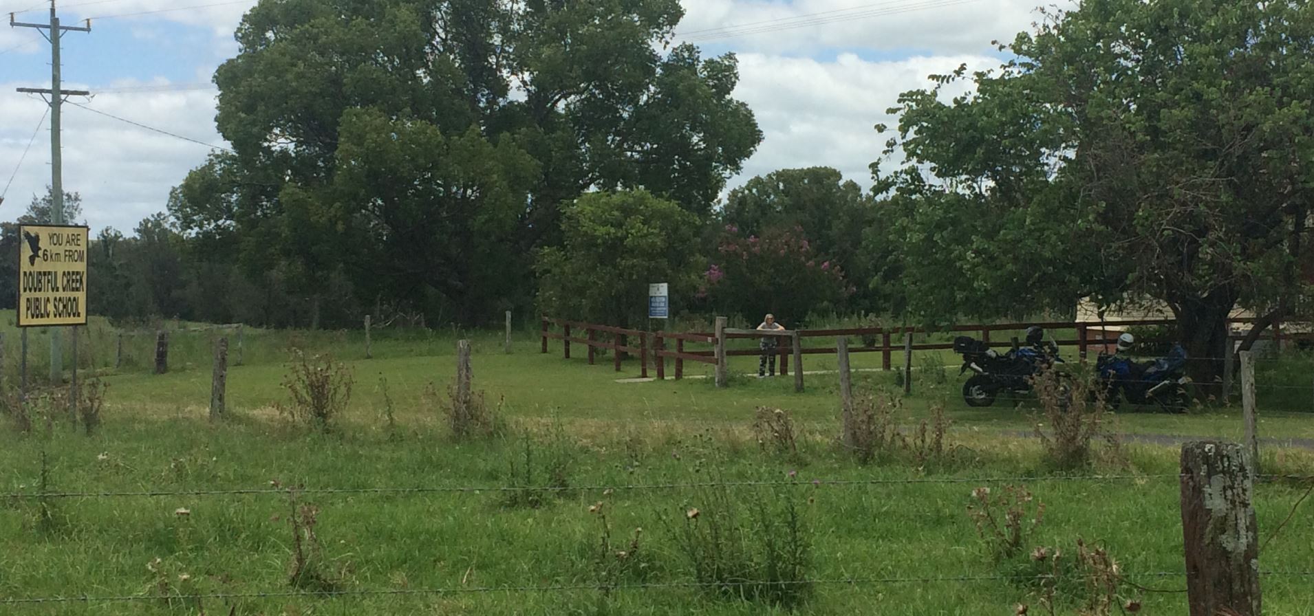
As we were now on the wrong side of the Clarence River, a crossing was required albeit with no wetting of feet at a concrete causeway surrounded by a popular camping spot. We didn’t stop for photos as some of the campers looked as though they wanted to play the banjo arrangement for Duelling Banjos and neither Cindy nor I can play guitar.It was a reasonably long run down a weird mix of dirt and random sections of bitumen along the Clarence Way before joining the Summerland Way and entering Grafton for our first night’s stay. A motel in town and a walk across the Clarence River to the packed RSL for a few beers and the roast of the last day was the order of the evening, before a walk back to our room to bring in 2016.
We were operating on Auckland NZ time at this stage as we had to get up early for a big second day; however Grafton stepped up magnificently with a spectacular 15 minute fireworks display from the convenient launching pad of the shopping centre roof across the road when the clock struck midnight in Auckland. Motel guests in their pyjamas didn’t even have to put on shoes to witness a series of exploding crescendos, each more traumatic to Grafton Shih Tzu’s than the last. Certainly one of the better displays we’ve seen anywhere.
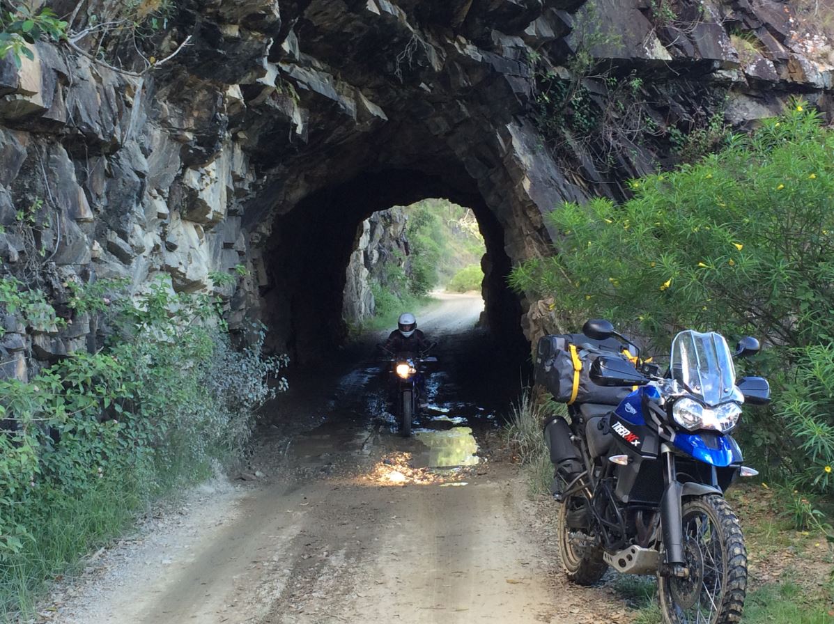
Day two plan was along the Old Glen Innes Rd which starts just out of Grafton off the Gwydir Highway and loops south and west before running alongside the Boyd River. It is similar beautiful scenery to the Rocky River near Tenterfield, steep countryside and grassy flat areas dropping into the meandering river, although happily a lot fewer cows. The route was once the main road from the New England towns to the coast, and the river was the location of a brief gold rush around Dalmorton which apparently had 13 pubs, unfortunately none have survived to greet two coffee demanding adventure riders.
The road is most famous for a 20m tunnel carved by hand through an inconvenient rock spur which plunges directly into the river. The tunnel was built in the 1860’s by a contractor using convict labour, if the tunnel contractor was like civil contractors today I suspect he probably didn’t think mentioning his convict rates before offering up a lump sum price was important.
The remainder of the road was dirt followed by extremely twisty bitumen climbing out of the river valley, before the eventual reuniting with the Gwydir Highway and the run into Glen Innes where the public holiday had resulted in closure of everything. Except Maccas. So yet another McCafe coffee and a guilt ridden non-adventure riders lunch was had before heading down the New England Highway. A brief stop for fuel at Armidale, and a stop in Tamworth for the mandatory Golden Guitar photo for Cindy (reminder to any Clarence River crossing campers – she can’t play) with Johnny Cash lined up on the playlist, and then it was down the road to Willow Tree. At Willow Tree the highway trends south and east, whereas we needed to continue south and west to Merriwa and Mudgee. So we took the Merriwa Road, which started off as good country back road bitumen.
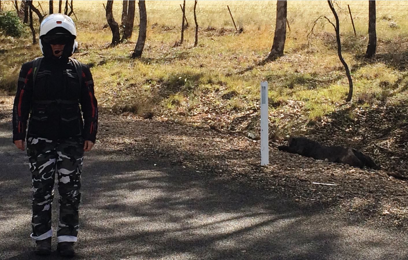
About 15km out of Willow Tree at Warrah and cruising nonchalantly along at 100kmh, the classic double-take occurred. Normally the sight of looming road kill causes immediate breath-hold response hopefully before hitting the thick stench curtain, but on this occasion the sight overwhelmed all olfactory preservation mechanisms. A slamming on of brakes and turnaround was the immediate result, with Cindy taken by surprise to see a blue Triumph Tiger XCx and rider with my outfit on coming back toward her. One look by Cindy at the road kill however, and I was forgotten.
Here lying by the side of the road was the clear evidence of pumas and panthers in Australia that had previously only been seen by the friend of the cousin’s mate in his tent, and gone before he could deploy his camera. Although my scepticism was still intense, unfortunately it wasn’t so intense that I could ignore the smell long enough to do a CSI Miami on the corpse. The best we could manage was a few close-ish photos and some photos trying to give some scale reference to show that it was very large. After gathering the evidence from a downwind perspective, it was back on the bikes to continue to Merriwa while speculating on how a black panther may have got itself on the side of a quiet NSW country road.
The Merriwa Rd was a bit like the Clarence Way, bitumen sections varying between very fast down to really twisty and then unexpected lengths of dirt road. After about an hour of riding and independent build-up of a catalogue of big cat theories, we rolled into Merriwa with little knowledge of how large the place is and whether there would be a place to stay. Merriwa isn’t large and a full lap of the place only took about a minute, which revealed that there was a nice looking B&B, a pub, and a motel that looked very empty. There didn’t appear to be a puma or panther breeding facility, but we didn’t leave the main street and anyway I had decided it would be a secret location in accordance with the conspiracy theory of the moment. The B&B on Bettington was the destination of choice because it looked nice and it was right in the Merriwa action, and we weren’t disappointed.
The dinner options on New Year’s Day were limited to the RSL or the pub, and as the pub was about 5 yards away it was considered safer in case the panther we had seen had been part of a mass break-out from the secret facility. It turned out to be a real winner, or at least I did when I won $300 at the bar raffle without even having to buy a ticket. The locals seemed a bit miffed that some out-of-towner had scooped the pool, so to avoid hostilities breaking out I shouted the bar although by the time I got around to it there were only three people left. The winnings paid for a couple of very good steak dinners and a few drinks to aid the getting-ever-wilder panther conspiracy theory development. Cindy soon recruited other patrons to her brainstorming team including a lady from Newcastle Radio, however ideas to release the story and pictures to start a bidding war between channels 7 and 9 and become famous were tragically unable to be realised due to our tight schedule and inability to find a suitable agent amongst the four people in the pub bistro.
Having survived the trip back to the B&B and the night almost certainly due to liberal application of Aerogard – Big Cat Strength, and after a nice breakfast provided by the B&B owner Pam we headed off to the planned coffee stop at Mudgee. The official planned route was via the Goulburn River National Park and Wollar; however Cindy decided that she would go via the town of Ulan as she was curious if this was the origin of “Oil of Ulan”. Whoever got to Mudgee first would select the coffee establishment.
The Goulburn River NP and the one kilometre hiking trail to get some nice views was well worth it even though as the first tourist of the day I had to walk through a million spider webs, fortunately “unmanned” with the exception of one. Motorcycle jackets have lots of hiding places for biting arachnids so it was not worth worrying about, even though I did. The Goulburn River rises near Mudgee and winds its way east through the rocky escarpment of the park before eventually joining the Hunter River in the valley of the same name, confusingly it goes nowhere near Goulburn.
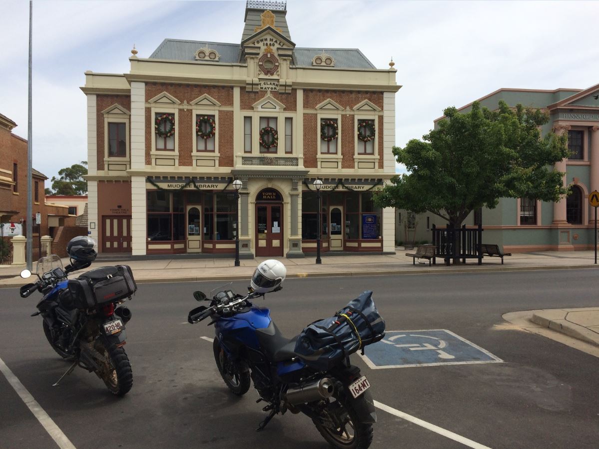
Cindy had discovered that instead of an “Oil of Ulan” DFO there was a big coal mine, and so beat me into Mudgee by about half a coffee. The place just reeks of a fabulous place to stop for coffee as it is clean and picturesque, we got a park in the main street opposite the town hall right outside a good café, and even the weather was perfect. There are a fair number of wineries evident in the surrounding area, so it also reeks of a fabulous place to stop for longer than we could.
After a very nice coffee with banana bread and a chat with some locals envious of our freedom, but oblivious to the risks we take riding around in areas swarming with predatory cats, we were off to the bucket list destination of Hill End which was about an hour away down a sometimes very fun and windy bitumen road.
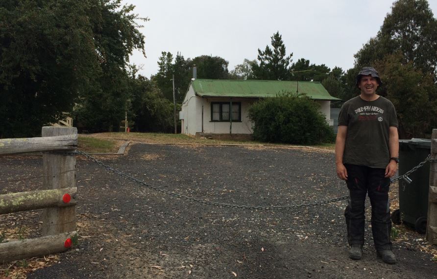
Historic Hill End is a popular weekend destination between Mudgee and Bathurst and not far from the original official location of the discovery of gold in Australia in the 1850’s. It was a boom place in the 1870’s and built up to a large town of nearly 10,000 people with the usual gold mining town accoutrement of at least two pubs per 1,000 head of population. The decline and fall of Hill End was very rapid, and so strangely the remaining town is actually run by the NSW Parks and Wildlife Department who act as the town council and look after the rubbish and the public spaces.
The town still has well preserved churches and buildings from the 1870’s and a vaguely active gold mining company at which I spent six months in 2009 running the gold plant. Hill End had got onto the bucket list because Cindy had never been there, and I had always regretted not buying a lump of the nuggetty gold while I was working there. We arrived just before an acceptable time for lunch at the pub, so took the opportunity to have a wander around and buy a piece of gold.
Cindy was subjected to intrepid tales of my time there including the 40°C days in January and the freezing cold and snow in June, and the total blackness of an 1870’s town without streetlights at night which caused me to stop going to the pub as the place was crawling with big kangaroos and I feared getting beaten up. Luckily I wasn’t aware at the time that there were probably gangs of panthers cruising about.
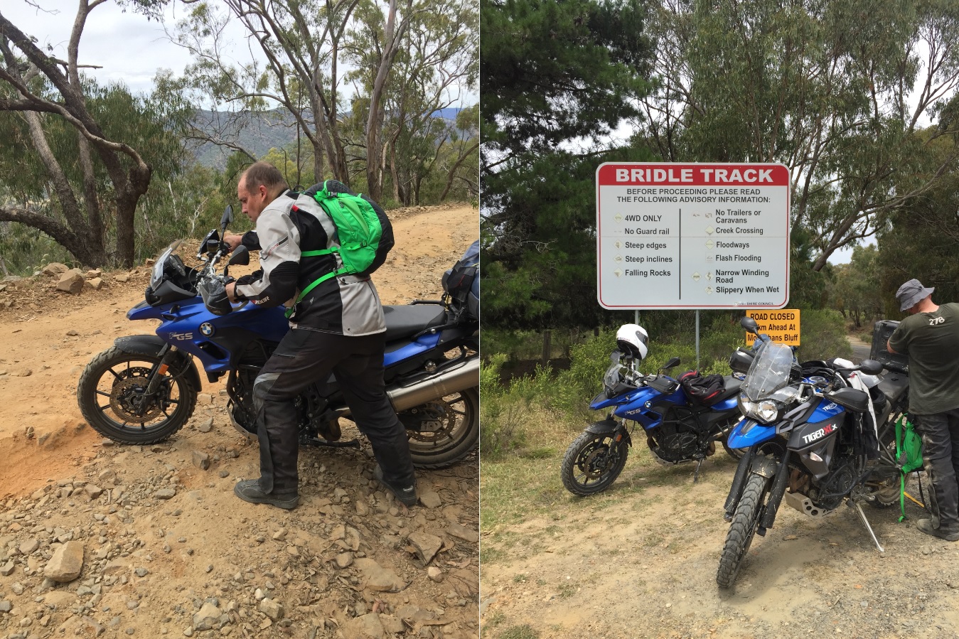
After lunch we rode out to a lookout which highlighted how steep the hills the miners were working on at Hill End, before deciding to take a quick ride down the first part of the famous Bridle Track. The Bridle Track is a dirt road via the Turon and Macquarie River valleys which takes about 30km off the distance to Bathurst from Hill End than the road via Sofala, but includes some sections across really scary steep country. The track has been closed for about five years due to a slip about 18km from Hill End, but is still popular for 4WD enthusiasts to access campgrounds on the rivers.
We made it about a kilometre down before deciding to turn around in a spot that was not wisely chosen, which resulted in a sweaty one thousand point turn for Cindy’s GS incorporating language that would have made any bridal parties using the Bridle Track blush, and an undignified dropping of the Tiger which broke an important clip on the luggage. Fortunately a kindly 4WDer passing on his way back to Hill End offered to cart the luggage back up for me which saved the difficulty of carrying out repairs on a steep, rocky, and narrow track with frequent traffic. After another drop of the Tiger and a lot more swear words, all members of the party were successfully moving, and as always riding up was a lot faster and easier than riding down.
Following the luggage repairs we had some refreshments at the little Hill End shop where we were served by a fit looking man who had just ridden across the Simpson Desert on a Triumph Tiger XC, making our performances on the Bridle Track seem even more shameful. He said he’d dropped his tyre pressures down really low and it made it easy in the sand although everyone said he would shred them, but that didn’t happen so I might try that next time.
Refreshed and slightly less sweaty, we were back on the bikes and I led the charge down the road toward Bathurst which is all bitumen these days. Due to a missed corner marking rendezvous which resulted in my mistaken return to Hill End adding another 60km onto my day, I arrived into Bathurst two cups of tea and a lie down behind Cindy which had allowed her time to find a good motel within the city bounds. A meal and drinks and the opportunity to lose money on mathematically improbable Keno were available at the RSL just around the corner, and as it had been a big day we weren’t very late getting to bed to prepare for the last day to Nowra.
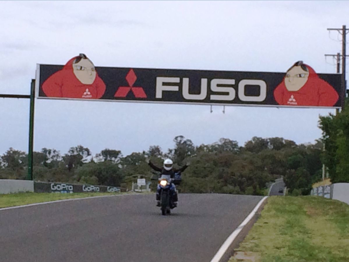
We were up bright and early as we had decided while in Bathurst that it would be un-Australian not to do a lap of Mt Panorama. The track is up one of the streets on the edge of the city, and riding along one suddenly finds that the potholed and rough complexion of Australian roads we are so used to has become a wide billiard table smooth surface. The track is a normal road with a strongly enforced 60kmh limit and two-way traffic; although I suspect most people driving it tend to follow the normal anti-clockwise direction as we didn’t see anyone coming the other way. The biggest surprise was how steep the road is coming down from Mt Panorama, I was too nervous to go into Brock mode because the road is so smooth that I couldn’t convince myself that it wasn’t really slippery.
After the lap and finding some fuel, we headed south through Oberon in a rapidly cooling climate which required closure of all zips and even fitting of the neck warmer and use of the heated grips. 13°C was not expected in nearly mid-summer. The road to the Abercrombie River to the south of Oberon was a true joy of fast sweeping bends, confirmed by the increasing number of sports bike enthusiasts coming the other way from Goulburn.
At the river valley, the road changed so suddenly from wide and fast bitumen to an incredibly steep and narrow windy road that we both thought we had somehow missed a turn to stay on the beautiful main road, however Mud Maps confirmed that there was no other road. Once out of the valley we drifted further south to Taralga for the mandatory coffee stop which including disrobing and opening of carefully selected zips to suit the warmer climate of the lower altitudes.
A direct route to Nowra from Goulburn is disturbed by the escarpment of the Illawarra and a large dam, but fortunately the most direct available is via Moss Vale and the motorcyclist’s Mecca roads leading into and out of Kangaroo Valley. Unfortunately the roads are also a Mecca for small cars, trucks, caravans, and cyclists because there really isn’t any other way to get between Goulburn and Nowra, so it wasn’t technically demanding putting along at 20kmh. If the road could be blocked off to all traffic except motorcycles it would be much better.
Kangaroo Valley village is like a lot of near-civilisation day tourist destinations with plenty of cafes and centres for unblocking your Chakra energy, but it is a very pretty place. As we’d been doing regular basic motorbike checks the Chakra’s were okay, so after four great days and 1500km we rode the remaining 25km BMWantly and Triumphantly into Nowra with the family lined up to see us and ready to present their own black panther conspiracy theories.
The ride home five days later was straight up the Princess Highway with no further panther sightings to report, obviously the mass breakout from the secret facility had been contained by then.